Around School Grid System
Worksheet Description
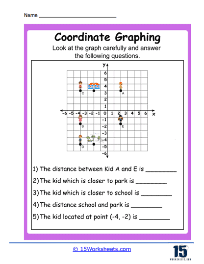
This worksheet is an interactive tool for learning coordinate graphing with a focus on real-world applications. The graph presented includes various points labeled with letters and icons representing different locations, such as a park and a school. Students are tasked with examining the graph to answer questions related to the spatial relationships between the points, such as distances and proximity to certain locations. The questions are structured to guide students through the process of interpreting the graph and applying their knowledge to specific scenarios.
The worksheet aims to teach students how to apply coordinate graphing to solve practical problems. It encourages them to understand the concept of distance within a coordinate system, requiring them to analyze which points are closer to reference locations like a park or school. This activity also helps in developing spatial reasoning skills as students determine the relative positions of points. Furthermore, by identifying specific points, such as the kid at (-4, -2), students practice reading coordinates and associating them with positions on the plane.