Coloring the 13 Colonies
Worksheet Description
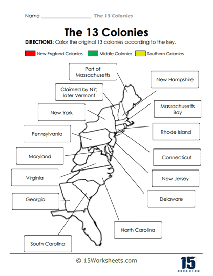
This worksheet features an outline map of the original 13 colonies with each colony labeled by name. The directions at the top of the page instruct students to color the map according to a provided key, which designates specific colors for New England, Middle, and Southern Colonies. The activity combines visual and cognitive learning by having students apply colors to differentiate the colonies based on their regional classifications. Additional notes on the map indicate territories claimed by certain colonies, such as New York’s claim on what would become Vermont.
The worksheet aims to teach students about the regional distinctions among the 13 original colonies of what is now the United States. By coloring the colonies according to the key, students are able to visually distinguish between the New England, Middle, and Southern colonies, reinforcing their understanding of the geographical layout of early American settlements. The coloring task also serves to enhance memory retention by associating each region with a specific color. Furthermore, the additional territorial notes provide insights into the historical claims and borders that were significant during the colonial period. An early look at our Jamestown series.