West Coast States
Worksheet Description
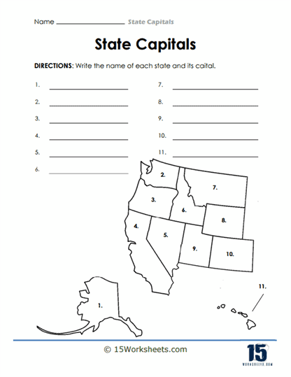
This worksheet is a geographical activity where students are tasked with identifying states and their capitals based on an outlined map of a region of the United States. The map is segmented into numbered sections, each corresponding to a state, with eleven states in total. Students are expected to write the name of the state and its capital on the provided lines next to each number. This exercise combines visual geography with written recall, as students must recognize the shape and relative location of each state on the map.
The worksheet is designed to teach students the names and capitals of the states within a specific region of the U.S. It helps to develop their ability to recognize states by their geographical outline and location. The exercise also enhances students’ memorization of state names and their corresponding capitals. Furthermore, this activity aims to strengthen spatial awareness and understanding of regional geography within the context of the United States.