Northwest States
Worksheet Description
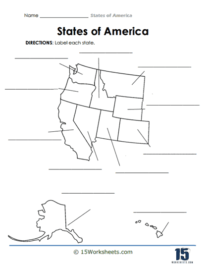
This worksheet presents a segmented map of the United States, isolating a select group of states along with a separate depiction of Alaska and a few Hawaiian islands at the bottom. Labeled “States of America,” it instructs students to identify and label each state based on their shapes and relative positions. The map is simplified, with lines branching out from each state’s border to provide space for labeling. The clean design emphasizes the unique configurations of the states, aiming to challenge students’ recognition skills without overwhelming them.
The central aim of this worksheet is to enhance students’ familiarity with U.S. geography, particularly concerning the illustrated states. By requiring them to label the states, the activity ensures that students not only recall state names but also recognize their distinct shapes and geographical placements. It serves as an engaging tool to anchor knowledge about U.S. states and their positions relative to one another. Beyond geographical knowledge, such exercises encourage precision and observational skills, critical for various academic and real-world applications.