Southeast States and Their Capitals
Worksheet Description
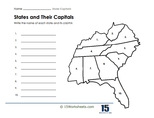
This worksheet is a geographical exercise designed for students to identify and write down the names of states and their capitals in the United States. It features an outline map with ten regions marked by numbers, each representing a different state. Next to the map, there are numbered lines where students are expected to write the corresponding state name and its capital. This activity requires recognition of state shapes and knowledge of their capitals.
The worksheet is intended to teach students the geographical locations and capitals of the states represented on the map. It reinforces their ability to identify states by shape, as well as their memorization of the respective capital cities. By completing this exercise, students enhance their understanding of U.S. geography and improve their recall abilities. This type of worksheet is essential in building a foundational knowledge of the country’s political and geographical divisions.