Naming Colonies
Worksheet Description
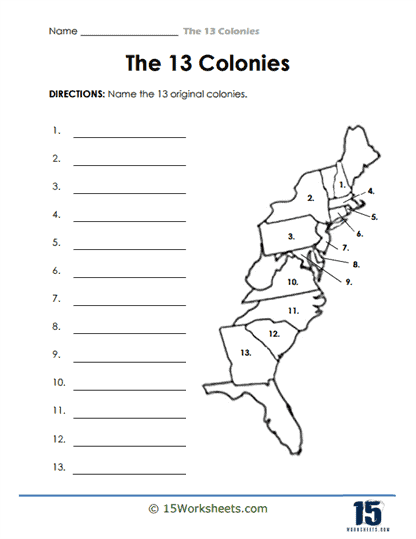
This worksheet presents a simplified map of the eastern seaboard of what would become the United States, marked with numbers 1 through 13 to indicate the geographic locations of the original 13 colonies. Students are tasked with identifying each colony by writing its name next to the corresponding number. The map does not provide any names or additional clues, thus requiring students to rely on their existing knowledge or to conduct research to complete the task. The activity is designed to test and reinforce students’ recall of the 13 colonies and their geographical placement.
The worksheet is intended to teach students the geographical locations of the original 13 colonies, an essential aspect of early American history. By correctly naming each colony, students reinforce their understanding of where these colonies were situated and how they were distributed along the Atlantic coast. This exercise enhances their ability to visually associate each region with its historical counterpart. Furthermore, the worksheet serves as a foundational tool for students to understand the early colonial layout that would eventually influence the political and social development of the nation.