Middle Country
Worksheet Description
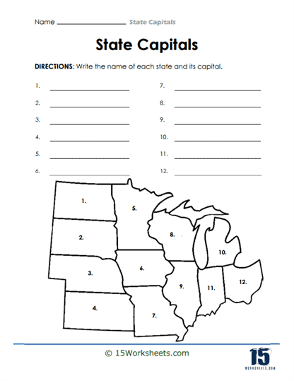
This worksheet features an outline map of a section of the United States, divided into numbered areas representing different states. There are twelve numbered lines corresponding to the numbered regions on the map, where students are directed to write the name of each state and its capital. The exercise requires students to utilize their knowledge of U.S. geography to correctly identify each state by its shape and location on the map. The activity combines visual identification with recall of factual information.
The purpose of this worksheet is to educate students on the state names and capital cities of the United States within a specific geographic area. It aims to strengthen their ability to recognize states by their geographic outlines and to recall the associated state capitals. This task aids in the development of geographical knowledge and spatial intelligence. Completing the worksheet also helps reinforce memorization and recall skills, which are essential for learning complex geographical information.