Mapping Majesty
Worksheet Description
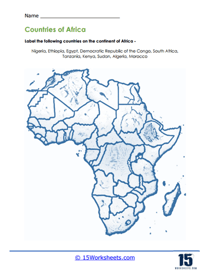
This worksheet is a geographic exploration task that invites students to identify and label key countries on an outline map of Africa. With a clear representation of the continent’s political boundaries, students are asked to place the names of Nigeria, Ethiopia, Egypt, Democratic Republic of the Congo, South Africa, Tanzania, Kenya, Sudan, Algeria, and Morocco in their correct locations. The activity is designed to test and enhance students’ knowledge of African geography, focusing on some of the continent’s most prominent nations.
The aim of this worksheet is to teach students about the geography of Africa and to familiarize them with the location of its various countries. It encourages students to recognize and remember the shapes and relative positions of these countries within the continent. This educational task helps build their map-reading skills and geographical awareness. By labeling the countries, students will also develop a better understanding of Africa’s diverse political landscape and the relationship between neighboring nations.