Lower Central States
Worksheet Description
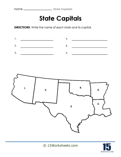
This worksheet is a geographic identification activity that requires students to name states in the United States and their corresponding capitals. A map highlighting a particular region of the U.S. is shown with six numbered sections, each representing a different state. Students are asked to write the name of each numbered state and its capital on the provided lines corresponding to the numbers. This exercise is designed to enhance students’ ability to recognize states by shape and location, and to know their capitals.
The worksheet aims to teach students the names of certain states and their capitals, focusing on a specific region of the United States. It helps students practice their recall of state names and capital cities and fosters geographical awareness. By associating the visual element of the state’s shape with its name and capital, the worksheet enhances memory retention. This type of activity is essential for building foundational knowledge in U.S. geography.