Longitudinal Degrees
Worksheet Description
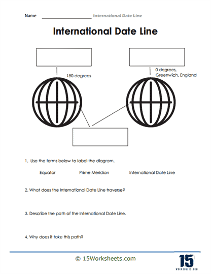
The worksheet presents a simplified visual representation of Earth with indications of specific longitudinal degrees, particularly 0 degrees at Greenwich, England, and 180 degrees. The diagram is accompanied by a set of questions and terms, guiding students to label key geographical markers, including the Equator, Prime Meridian, and the International Date Line. Additionally, the worksheet inquires about the path and rationale behind the International Date Line’s trajectory. The illustration and questions combined aim to offer a foundational exploration of this key geographical and timekeeping concept.
Through this worksheet, students are introduced to the core principles of Earth’s longitudinal divisions, particularly the Prime Meridian and the International Date Line. It endeavors to foster an understanding of the significance of Greenwich, England, as the starting point of longitudinal measurement. The exercise encourages learners to visualize and recognize the spatial relationship between the Prime Meridian and the International Date Line. Lastly, by asking students to ponder the path and reasoning behind the International Date Line’s establishment, the worksheet promotes critical thinking about the intricacies of global timekeeping and navigation.