Across the World

Worksheet Description
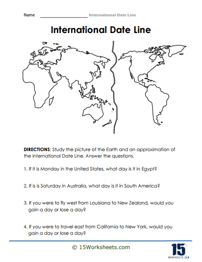
This worksheet presents a visual representation of the Earth, emphasizing an approximate delineation of the International Date Line (IDL). Students are directed to study the provided illustration and then answer a set of questions that test their comprehension of the IDL’s influence on day-to-day situations, including its effect on time and date when traveling between specific global locations. The questions explore scenarios such as the date variation between the United States and Egypt or the outcome of a journey from Louisiana to New Zealand in relation to the IDL.
The worksheet’s objective is to foster a solid understanding of the International Date Line’s practical implications. By inquiring about specific travel instances and their time and date outcomes, students are prompted to apply the theoretical knowledge of the IDL to tangible situations. Through these questions, the worksheet intends to clarify misconceptions about day-to-day life across the IDL, underscoring how travel direction can result in gaining or losing a day. Overall, the aim is to combine geographical learning with the real-world effects of time-zone transitions influenced by the IDL.
