Teacher’s Questions
Worksheet Description
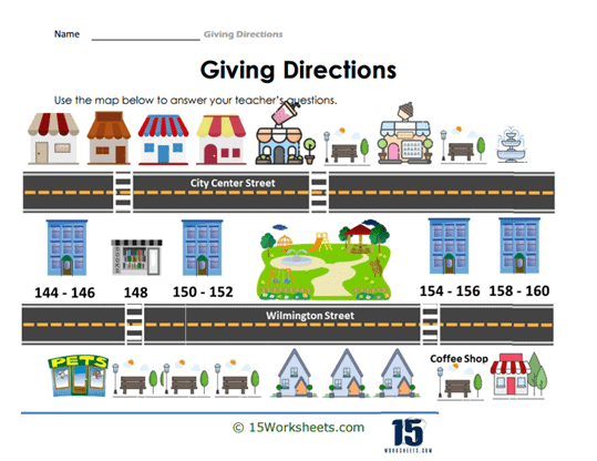
The “Giving Directions” worksheet showcases a colorful, illustrated street map with two roads: City Center Street and Wilmington Street, adorned with various shops, services, and a park, each labeled with street numbers. The purpose of the worksheet is to utilize the provided map to answer questions posed by the teacher, which would typically involve navigating from one location to another on the map. The detailed illustrations and clear numbering system on the buildings aid students in visualizing the layout and distances between locations. This interactive map is designed to engage students with practical tasks in spatial orientation and navigation.
This worksheet is crafted to develop students’ abilities to understand and interpret maps, a fundamental geographic skill. It teaches them to recognize landmarks, follow street layouts, and provide directions using specific addresses. The worksheet also encourages the development of clear communication skills, as students must articulate their directions in a manner that is easy to understand. By engaging with this activity, students learn to translate a visual representation of space into verbal or written instructions, enhancing both their navigational and descriptive language skills.