To The Bank
Worksheet Description
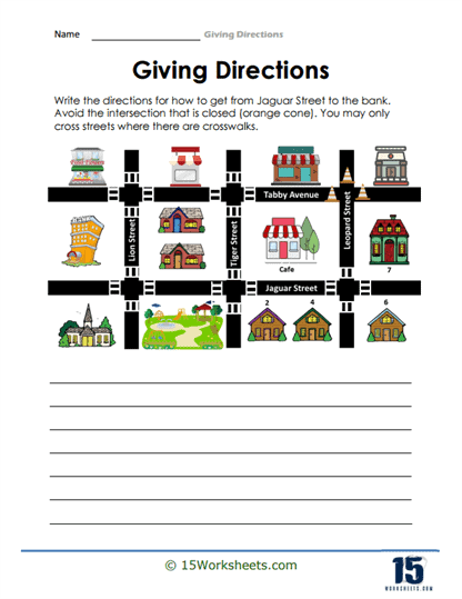
The “Giving Directions” worksheet presents a grid-like map of a neighborhood with Jaguar Street at the bottom and Tabby Avenue at the top, featuring various buildings such as a cafe, houses, and a bank. An orange cone indicates a closed intersection that must be avoided. Students are instructed to write directions from a location on Jaguar Street to the bank, with the stipulation that they can only cross streets at crosswalks. Lines are provided beneath the map for students to write out their directions, integrating spatial reasoning with written communication.
This worksheet teaches students how to navigate a simple map and plan a route that takes into account specific constraints, like road closures and pedestrian crossings. It reinforces the importance of following traffic rules and safety while navigating urban spaces. The activity enhances critical thinking and problem-solving as students must determine an alternative path due to the closed intersection. Additionally, it allows students to practice writing clear and precise directions, a skill that is crucial for effective communication and real-world orientation.