Down Under Discovery
Worksheet Description
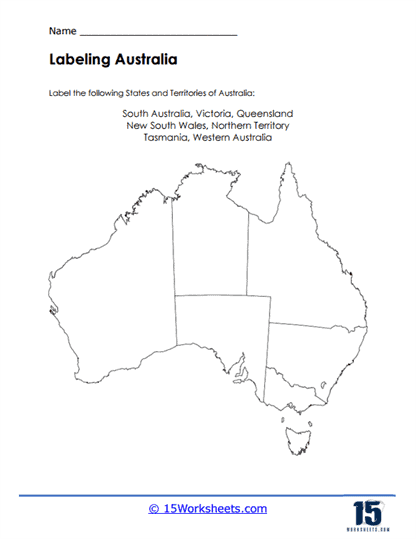
This worksheet presents an outline map of Australia, tasking students with labeling the states and territories that comprise the nation. It lists South Australia, Victoria, Queensland, New South Wales, Northern Territory, Tasmania, and Western Australia as the regions to be identified. Students are challenged to accurately place these names on the corresponding areas of the blank map. This exercise not only tests but also helps to reinforce their geographical knowledge of Australia’s political divisions.
The goal of this worksheet is to strengthen students’ understanding of Australian geography by identifying and labeling its constituent states and territories. It teaches the relative locations of these regions, fostering spatial awareness and memory recall. The activity encourages learners to engage with the map critically, helping them to visualize and remember the shape and position of each state and territory. By completing this task, students will have a firmer grasp on the geography of one of the world’s most unique and diverse countries.