Continent Connection
Worksheet Description
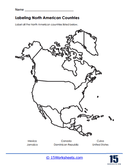
This worksheet presents a map activity that challenges students to identify and label several countries within the North American continent. It features an outline of North America’s diverse geography and includes larger nations like Canada, Mexico, and the United States, as well as smaller countries such as Jamaica, Cuba, and the Dominican Republic. The task is to correctly label each country, using geographical knowledge and spatial skills to place the names in the appropriate location on the map.
The aim of this worksheet is to enhance students’ geographical literacy by familiarizing them with the political boundaries and locations of countries in North America. It teaches students how to identify countries based on their shape and position relative to one another. This activity also encourages critical thinking and attention to detail as students differentiate between mainland countries and island nations. By completing this exercise, students will deepen their understanding of North American geography and improve their map-reading skills.