Temperatures Across the Country
Worksheet Description
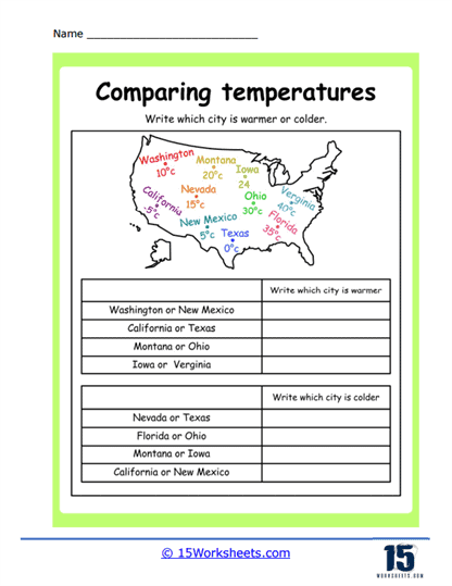
This worksheet is a geographical temperature comparison activity that features a map of the United States with selected cities labeled and their corresponding temperatures. The temperatures are listed in degrees Celsius beside each city. Below the map, there are questions prompting students to write which city is warmer or colder by comparing pairs of cities from the map. The task is designed to encourage students to analyze the map to determine the relative temperatures of different locations.
The worksheet is teaching students to interpret temperature data in the context of geography, helping them to understand how temperatures can vary by location. It encourages the practice of comparing numerical values and applying this to real-world situations, such as weather patterns across the United States. By identifying which city is warmer or colder, students also learn about regional climate differences within the country. The activity combines skills from both science and social studies, providing a cross-curricular learning experience.