Coloring Countries and Oceans
Worksheet Description
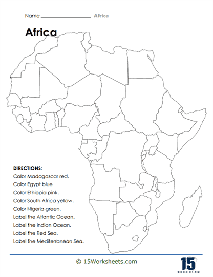
The worksheet is a map-based coloring and labeling activity focused on the African continent. Students are given directions to color specific countries-Madagascar, Egypt, Ethiopia, South Africa, and Nigeria-in designated colors. Additionally, they are instructed to label significant bodies of water surrounding and within Africa, namely the Atlantic Ocean, the Indian Ocean, the Red Sea, and the Mediterranean Sea. This hands-on task combines visual identification with geographical knowledge.
This worksheet is intended to teach students about the geography of Africa, including the location of certain countries and the surrounding bodies of water. By coloring and labeling the map, students reinforce their knowledge of where these countries are situated on the continent, as well as the position of important seas and oceans. The activity aids in the development of spatial awareness and geographical literacy. It also provides a visual and interactive way to remember key facts about Africa’s geography.