City Navigator
Worksheet Description
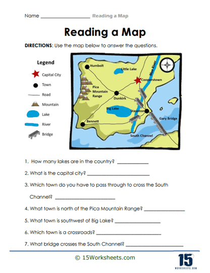
This worksheet shows a map of a country with labeled cities, lakes, mountains, and rivers. Students are asked to locate specific towns, identify landmarks like bridges and channels, and answer questions about the relative locations of features. The goal is to build geographic awareness and understand map symbols.
Working on this worksheet improves geographical knowledge and comprehension of map legends. Students learn to read and interpret maps, helping them understand the relationship between physical locations. It also boosts critical thinking as they answer questions based on their spatial understanding. This reinforces their ability to use maps in practical contexts.